Software Engineering
SeaFrame - Ecological Survey Automation Tool
October 20, 2024
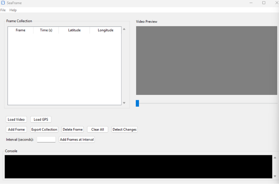
Automated tool reducing ecological survey field time by 40% and improving data quality, allowing clients to make more informed environmental decisions.

Automated tool reducing ecological survey field time by 40% and improving data quality, allowing clients to make more informed environmental decisions.
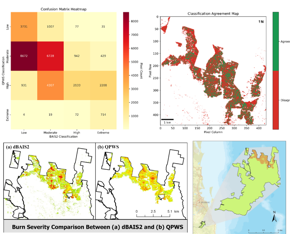
Real-time monitoring system enabling emergency services to respond to bushfires with unprecedented speed and accuracy, protecting communities and natural resources.
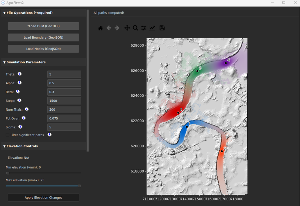
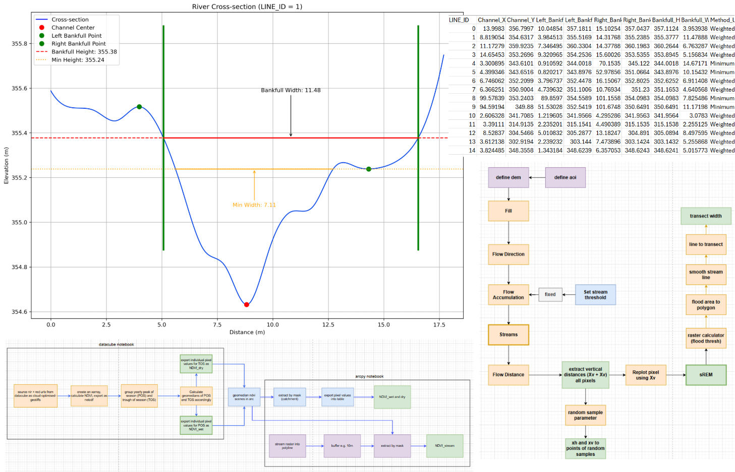
Water flow prediction system with 200% performance improvement and enhanced accuracy for environmental impact assessments, supporting better land management decisions.
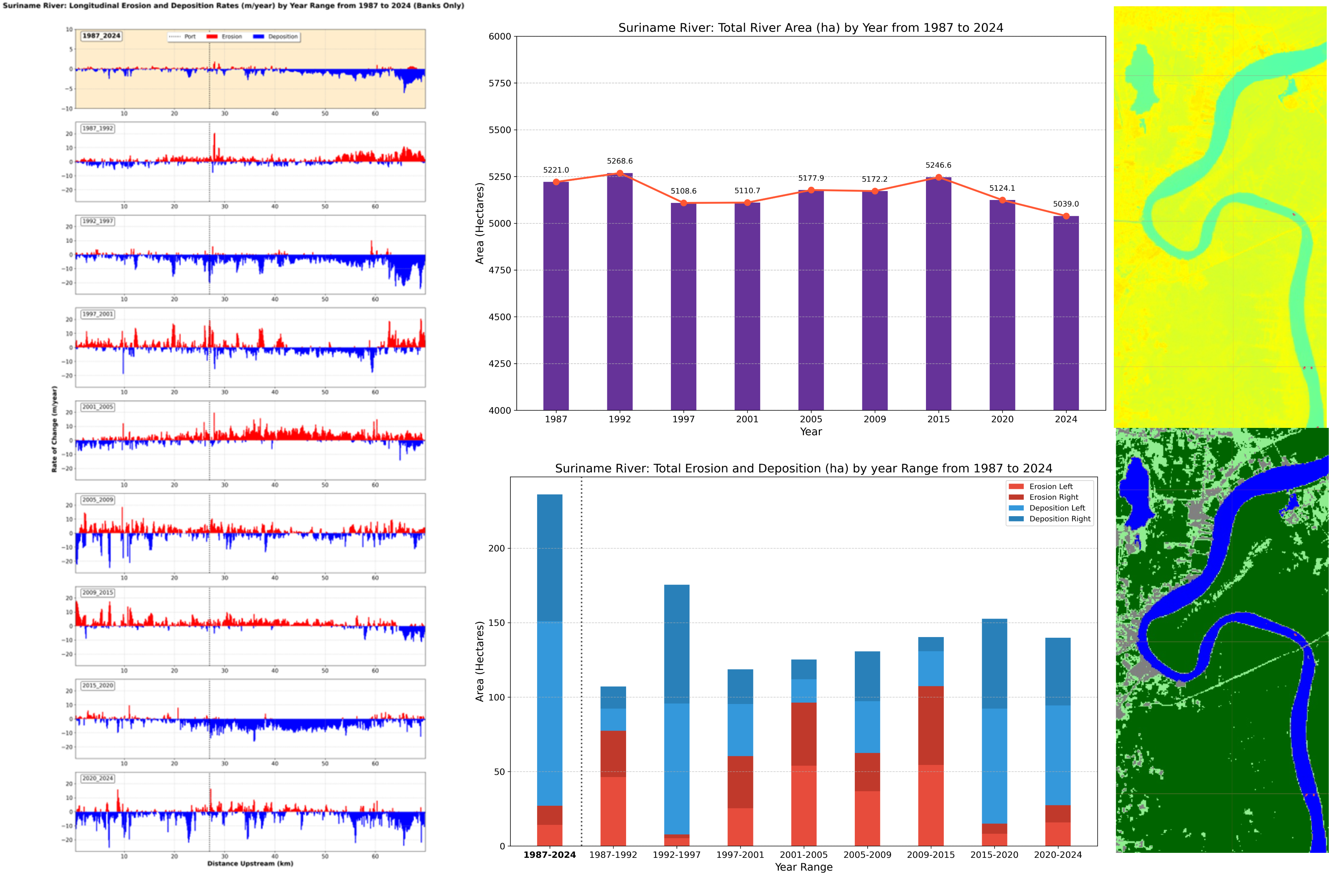
Analysis toolkit revealing decades of river movement patterns, providing critical insights for flood management and infrastructure planning in riparian zones.
Data automation system reducing processing time from 8 hours to 20 minutes, saving clients thousands in operational costs while delivering faster insights.
For streamlined GIS solutions, contact Streamlined Geospatial. Call 0493870216 to learn more.